In 1946 as Army Engineers surveyed a narrow river valley at the boundary of Gwinnett and Forsyth Counties. Mason J. Young, then South Atlantic Division Chief, looked out over the open expanse from one hillside to the next. This site was special and one that had been visited many times before over the years. "This is a storybook site for a dam. I've seen similar sites in the Northeast but there is always a city a few miles away. Here we have the site with no such complications. I don't think I've ever seen a better site for a dam".
Buford Dam and Lake Sidney Lanier have come to represent more than a single public works project. They are key links in a series of water projects constructed to develop the Gulf Intracoastal Waterway as part of a larger goal of bolstering national defense and augmentation of Southern resources. In these pages you will experience the development of the Apalachicola, Chattahoochee, Flint River System from the early 1800's to the sweeping postwar river and harbor legislation of the 1940's; the creation of a line of dams, locks, and reservoirs the entire length ofand personalities of the project's early promoters; flood control, navigation, water resource, power production, and recreation as multiple benefits; the appropriation by Congress of millions of dollars over nearly a decade; acquisition of over 50,000 acres of private land for public use; the ground breaking in 1950; forebay and tailrace excavation; construction of the intake structure, powerhouse, main earth dam,bridge, and highway relocation and construction; Sidney Clopton Lanier's life and contribution; creation of a 38,000 acre lake and the historical landmarks it erased; the dedication in 1957; biographical information, appropriations, contractorial, impoundment, property acquisition information, and reservoir flooding statistics and you experience them both in words and through the eyes of the camera.
Lake Lanier Facts:
- Located in the foothills of the Georgia Blue Ridge Mountains
- ~39,000-acre Reservoir Area
- ~637 billion gallons of water — ~354 billion in the conservation storage
- ~650 miles of shoreline
- Headwaters of the Apalachicola/Chattahoochee/Flint (ACF) watershed
- Holds ~65% of the total managed reservoir conservation water storage in the ACF watershed
- Drainage basin is ~6% of ACF watershed drainage area
- Touches seven Georgia counties: Dawson, Forsyth, Habersham, Hall, Gwinnett, Lumpkin, and White
- Impounded by the Buford Dam and extends up the Chattahoochee and Chestatee Rivers.
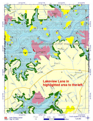
Click the map to see an aerial of the area we are located in.


